
Topographical
Mock Tests
Prepare confidently for your topographical assessment with our tailored mock test bundles.
We offer three plans: Bundle 1, Bundle 2, and the comprehensive Bundle 1&2, available with 30-day or 15-day unlimited access. Each bundle includes 3 sets of 25 multiple-choice questions.
Practice as many times as you like and build your confidence with these tests.
Free TfL Topographical practice test
Questions in the same style as the real assessment, with an explanation after each answer.
Over 700 drivers have tried our mock tests.
-
Question 1 of 10
Choose an answer, then press Check.
Romford is in the London Borough of Havering, on the eastern edge of Greater London.
-
Question 2 of 10
Choose an answer, then press Check.
Croydon is in south London, on the A23 road towards Brighton.
-
Question 3 of 10
Choose an answer, then press Check.
The M4 runs along the north side of Heathrow, and a spur from junction 4 leads straight into the airport.
-
Question 4 of 10
Choose an answer, then press Check.
The M11 runs north-east from London. Stansted Airport is at junction 8.
-
Question 5 of 10
Choose an answer, then press Check.
The Piccadilly line serves all Heathrow terminals. The Elizabeth line also goes there, but it is not an Underground line.
-
Question 6 of 10
Choose an answer, then press Check.
Kingston uses KT postcodes; the town centre is KT1. TW1 is Twickenham and SM1 is Sutton. KN is not a UK postcode area.
-
Question 7 of 10
Choose an answer, then press Check.
The A–Z uses "Gdns." for Gardens. Others to learn: Cl. = Close, Ct. = Court, Cres. = Crescent, Pk. = Park.
-
Question 8 of 10
Choose an answer, then press Check.
The M1 meets the M25 at junction 21. Junction 16 is the M40, junction 27 the M11 and junction 12 the M3.
-
Question 9 of 10
Choose an answer, then press Check.
Q is above P (North) and to its right (East), so you travel North East.
-
Question 10 of 10
Choose an answer, then press Check.
2 → East to 3 → East to 4 → South to 8 → South to 12 → West to 11.
Want more questions or more time? Try our free 2-day mock test: 28 different questions in the official format, including page-and-grid questions from the A–Z Master Atlas, with unlimited attempts for 2 days.
Start the free 2-day mock testPrefer paper? Get our free Topographical practice PDF: 33 more questions with an answer key, ready to print.
Try It Free
2-Day Access to Realistic Mock Tests
Get started with our 2-day free topographical mock test! Experience our platform and practice essential topographical questions at no cost. This free plan is perfect for familiarising yourself with the test format and building confidence before purchasing a full bundle. Start your journey to success today with this free opportunity!
Did you know?

Master the Test
15 Days of Full Course Access
Boost your preparation in a shorter time with our 15-day unlimited access plans. Perfect for those looking to intensify their practice, these plans are available for Bundle 1, Bundle 2, and the comprehensive Bundle 1&2. Enjoy unlimited attempts to refine your skills and gain confidence. Please note that these tests do not include route planning questions. Start practicing today and make the most of your 15 days! If it’s not enough, then scroll down the page!
- Online Course 24/7 access
- Unlimited Access for 30 Days
- Unlimited Repeat
- Multiple Choice Questions
- Please note that the best way to practise topographical route planning is in person. So our mock tests do not include route planning practice. Inside the bundles you will find the contact details of two independent instructors we recommend. They are not connected to us and we do not provide in person training ourselves.
Bundle 1
£11.99
Topographical Mock Test
15 Days
Unlimited Access
Link to purchase Best Textbook
Top 2 Instructor Contact Info
Bundle 1 & 2
£17.99
Topographical Mock Test
15 Days
Unlimited Access
Link to purchase Best Textbook
Top 2 Instructor Contact Info
Bundle 2
£11.99
Topographical Mock Test
15 Days
Unlimited Access
Link to purchase Best Textbook
Top 2 Instructor Contact Info
Check out the 30-day bundle bonuses
before you PURCHASE ANY packages.
Please note that the best way to practise topographical route planning is in person. So our mock tests do not include route planning practice. Inside the bundles you will find the contact details of two independent instructors we recommend. They are not connected to us and we do not provide in person training ourselves.
Days to Total Confidence
Complete Topographical Prep
Take your preparation to the next level with our 30-day unlimited access plans. Designed for thorough practice, these plans are available for Bundle 1, Bundle 2, and the all-inclusive Bundle 1 & 2. Enjoy a full month of unlimited test attempts to ensure you’re ready for the real assessment. Get started today and maximise your chances of success!
- Online Course 24/7 access
- Unlimited Access for 30 Days
- Unlimited Repeat
- Multiple Choice Questions
- Bundle 1&2 (30 days) is the most comprehensive plan, offering the most value for your preparation, and you can download a double-sided A4 guide packed with essential knowledge to support your test preparation.
- Please note that the best way to practise topographical route planning is in person. So our mock tests do not include route planning practice. Inside the bundles you will find the contact details of two independent instructors we recommend. They are not connected to us and we do not provide in person training ourselves.
Bundle 1
£19.99
Topographical Mock Test
30 Days
Unlimited Access
Link to purchase Best Textbook
Top 2 Instructor Contact Info
Bundle 1 & 2
£24.99
Topographical Mock Test
30 Days
Unlimited Access
Link to purchase Best Textbook
Top 2 Instructor Contact Info
Bundle 2
£19.99
Topographical Mock Test
30 Days
Unlimited Access
Link to purchase Best Textbook
Top 2 Instructor Contact Info
How the TfL Topographical assessment works
The Topographical assessment checks that you can read a map and plan a direct route around London. You need to pass it to get a London private hire (PCO) driver licence. It is taken on a computer at TfL’s assessment centre at Pier Walk, using an on-screen digital map, so you only need basic mouse skills. It costs £40 for your first attempt and £30 for a re-sit.
What is in the assessment
The assessment is marked out of 100 and the pass mark is 60%.
- Route planning (66 marks): three questions where you plot the most direct route between a green start marker and a red end marker: one short route, one short route with a road closure, and one long route. There are also true-or-false questions about a route planning scenario.
- Multiple choice (34 marks): understanding map symbols, finding places of interest, finding specific streets, identifying road numbers, and compass points and directions. Some questions have one correct answer and some have two; the question tells you which.
How route answers are marked
Route planning carries the most marks. Our step-by-step route planning guide has a worked example. You lose marks for:
- not starting or finishing in the right place
- planning the route in reverse
- not following the most direct route
- using a road or making a turn that the map symbols show is not allowed (for example a one-way street or a banned turn)
How to prepare
- Learn the map key. One-way arrows, no-entry signs and banned turns decide whether a route is legal, and symbol questions come straight from the key.
- Know your compass points. Be quick with North, South, East and West and the in-between points such as North East.
- Learn the big picture of London: which areas are north, south, east and west of the centre, the main motorways and where they join the M25.
- Read every question twice. Look for road closures in route questions and for “choose two answers” in multiple-choice questions.
- Practise under time pressure with mock tests until the multiple-choice sections feel easy, so you have more time for the route questions.
- Practise route planning on a real map. Because route planning is worth two-thirds of the marks, practise it with an instructor or study partner as well as on your own.
Common mistakes
- Missing a road closure mentioned in the question.
- Choosing a “quick” route that uses a one-way street the wrong way.
- Selecting one answer when the question asks for two.
- Spending too long on one multiple-choice question and rushing the routes.
Information checked against the official TfL Topographical assessment guidelines, November 2026. Always check TfL’s website for the latest fees and rules before you book.
Topographical assessment FAQs
What is the pass mark for the TfL Topographical assessment?
The assessment is marked out of 100 and you need 60% or more to pass. Route planning is worth 66 marks and the multiple-choice questions are worth 34 marks.
How much does the Topographical assessment cost?
According to TfL, it costs £40 the first time you take it and £30 for a re-sit.
Where do I take the Topographical assessment?
It is taken on a computer at TfL’s driver assessment centre at Pier Walk in London. You only need a basic understanding of how to use a mouse.
What topics does the assessment cover?
Route planning between two locations (including a route with a road closure), route planning true-or-false questions, map symbols, places of interest, finding streets, road numbers, and compass points and directions.
Do your mock tests include route planning?
Our mock tests cover the multiple-choice skills: map reading, places, streets, road numbers and compass directions. Route planning is best practised in person on a map, so inside our bundles you will find contact details of two independent instructors we recommend.
Can I try your Topographical practice questions for free?
Yes. You can try 10 free practice questions on this page with no sign-up, and you can also start our free 2-day mock test with 28 more questions.
How long do I get access to the mock tests?
You can choose 15 or 30 days of unlimited access, depending on the bundle. You can repeat every test as many times as you like during that time.

+1000 Exam-Style Questions

Unlimited Attempts

24/7 Access
WATCH THIS BEFORE START
YOU’ll GET MUCH MORE!
Introduction for Topographical Tests 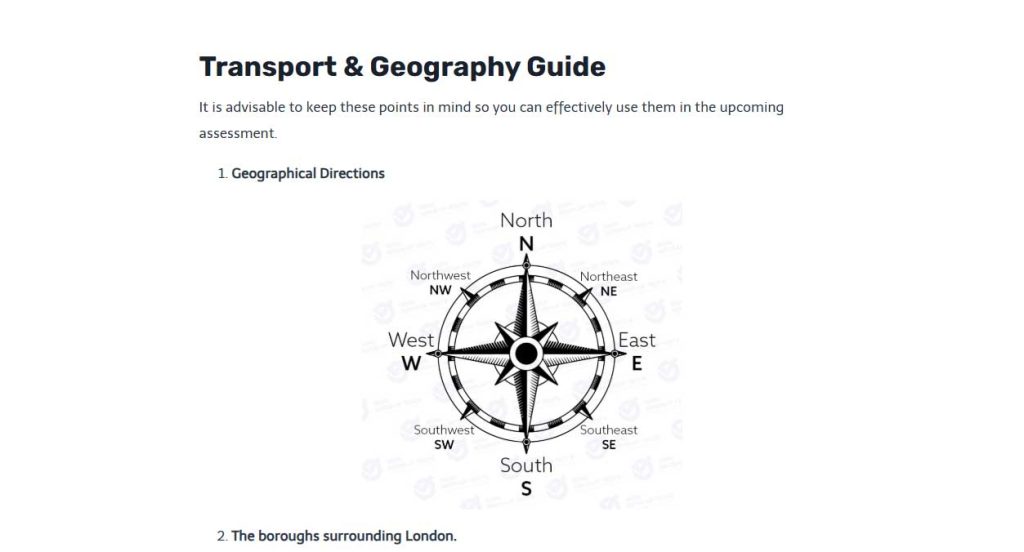
Learning Materials for Topographical tests 
Topographical Multichoice Questions (MSQ)